Friday, July 17, 2015

Evidence of Catastrophic Geology: Case 8

"Lake Tsunamis"

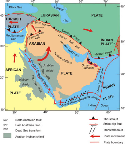
Tidal waves (tsunamis) do not only occur in oceans,  Catastrophic events can occur in lakes as well that cause large wave action.  Any lake within notable topography is typically at risk of experiencing a tsunami.  Lake Geneva in Switzerland has been studied impressively and geologic evidence indicates several tsunamis have occurred during the lake's existence.

As reported in Nature Geoscience, Dr. Kremer has performed notable study of the lake and theorizes that the recorded tsunami of 563 AD which devastated the city of Geneva (several historical accounts are available that describe the event) was caused by a landslide of massive rock debris into one side of the lake, destabilizing tall underwater canyons of soft deltaic sediment (where Rhone river feeds into lake).  The huge underwater global slope stability failures created the wave action that produced 0 to 14 meter tall waves (that is 46 feet max) that devastated many of the communities along the lake shores.

An image reported in the Economist magazine is presented below.


Beds (layers) of turbidite (alluvial deposits of high velocity water) in the lake help support the theory.  4 apparent beds totaling 20 feet thick may have been formed in just 4 single day events.  20 feet of wide-scale sedimentary deposit in 4 days, not millions of years.  

The layers are roughly 10km long (6 miles long) and 5km wide.  Organic material present in the first layer was carbon dated and closely matches the 563 AD age.  The sediment at the river delta also obviously accumulates very rapidly to form the dangerous underwater canyons.  Since the lake is suspected to have formed after THE ice age, the frequency of the tidal waves is a cause for concern.  When is the next one?


Evidence of Catastrophic Geology: Case 7

Rifting of tectonic plates can occur much faster than understood by many laymen.  As reported in the journal Nature in 2006, the crust on the side of the Red Sea rift moved apart by 26 feet over a period of just 3 weeks.

Magma entered the crack forming new crust.  Images from the European Space Agency's Envisat radar satellite were used (before and after) to validate the measurement.

A series of small earthquakes had occurred in east Africa the previous year, separating the rift in Ethiopia along a 37 mile long segment (East African Rift).  The Red Sea Rift can be seen in the illustration below.


(image from Saudi Arabian Geological Society)


Satellite monitoring technology has only been recently available to track movement of land masses, and many more events will be examined with keen interest.

Monday, July 6, 2015

Difference between "fracture" and "fissure"

The terms "fracture" and "fissure" are used in my geotechnical engineering reports for Central Texas geology (i.e. limestone formations typically).  These are two different terms and not synonyms.  Both are "discontinuities" in a rock mass.  Discontinuities can be categorized as:

- Fractures
- Joints
- Bedding planes
- Cleavage or foliation
- Faults

When a crack forms along a rock cleavage plane, some prefer not to associate the term fracture with this type of discontinuity.  But joints are also fractures.

A fracture develops mechanically in rock due to a failure of structure under tensile stress (the initial stage of a crack) or stress-strain conditions due to environmental or man-made conditions.  When shear stresses parallel to the plane of the crack are out of equilibrium, sliding may occur (i.e. fault).

A fissure is a specific shape of fracture, one that is long and narrow.  It is also a discontinuity dividing an otherwise continuous rock material without separation in 2 of 3 dimensions (i.e. no sliding has yet occurred; separation in 1 dimension).  A fissure may be void or may have been filled in.  A fracture or a joint with a visible opening (aperture) and a long or deep alignment can be called a fissure.

Saturday, February 14, 2015

Empirical Evidence of Catastrophic Geology: Case 6

Glaciers in the early 21st century have generally been losing mass (melting) and "retreating" due to changes that occur in the climate.  Glaciers can experience cycles of growth and retreat.  The "Fox" glacier in New Zealand for example retreated 985 feet horizontally in 2014.  As glaciers in valleys retreat, the toe of the side slopes loses resistance (buttress) that permits shallow to deep slope instability failures.  The landslides add notable "sediment" to the valley and deposit variable thicknesses of sediment in an instant.  In addition, the glacier water collects more loose sediment from the side slopes from rainfall runoff and shallow slides, causing fast sediment building in the stream valley.  At the "Fox" glacier valley for example, valley sedimentation is occurring at a rate of more than 3 feet per year (another example of a relatively fast rate of buildup for a sedimentary deposit).  A photograph of the "Fox" glacier is provided below.